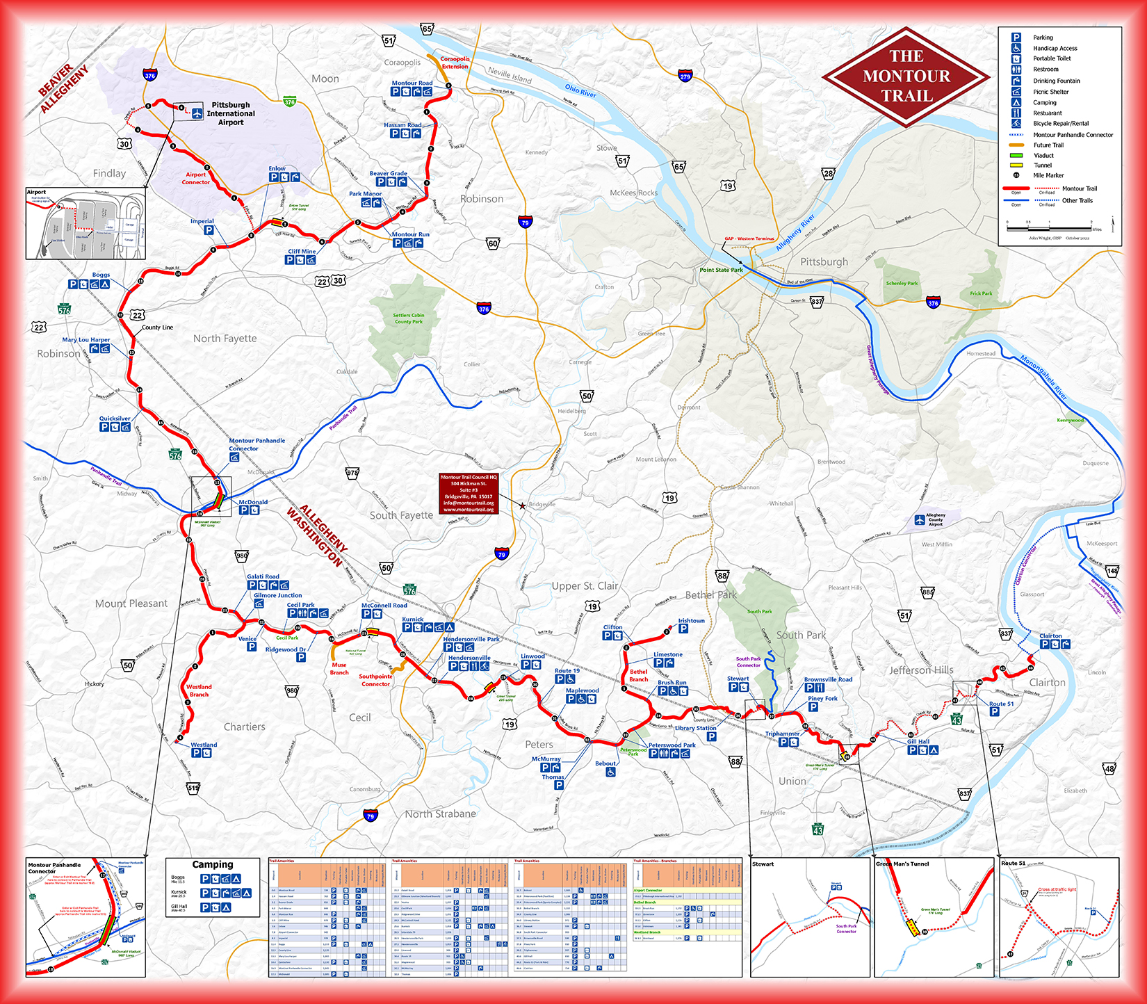
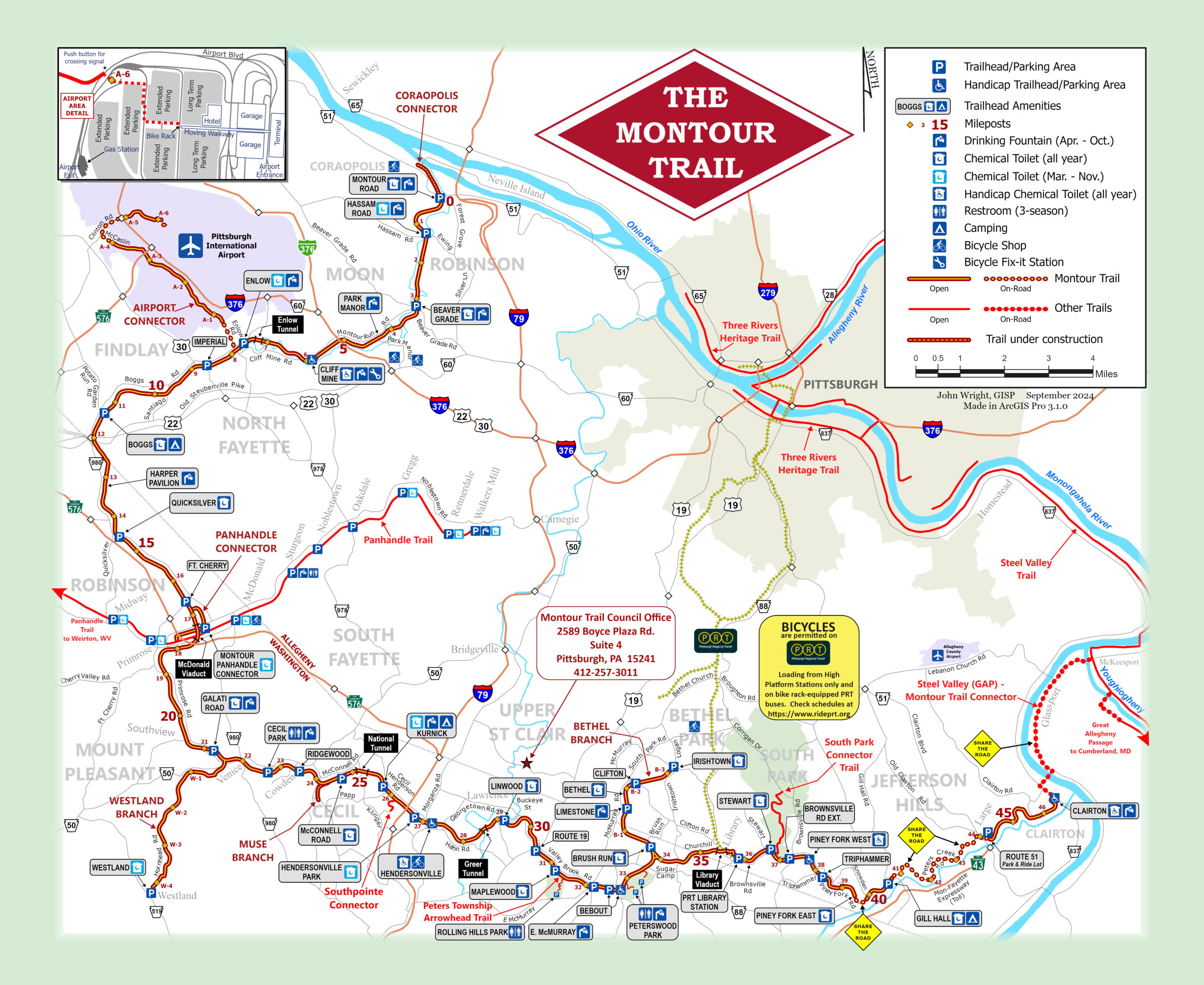
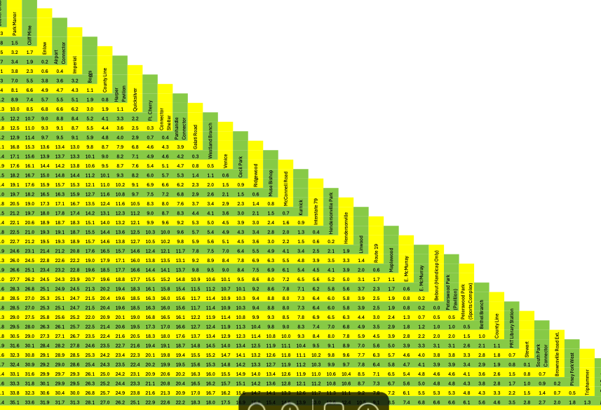
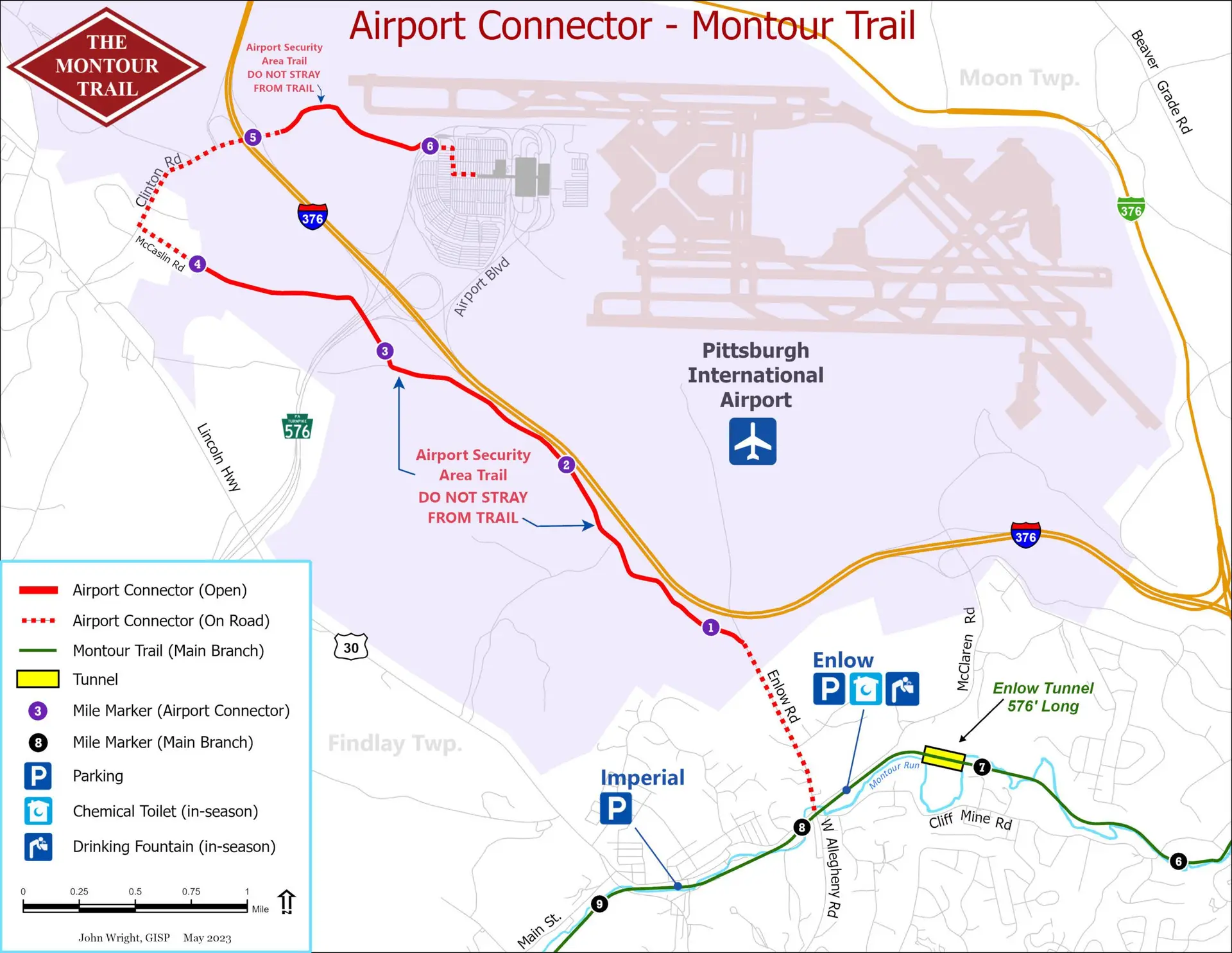
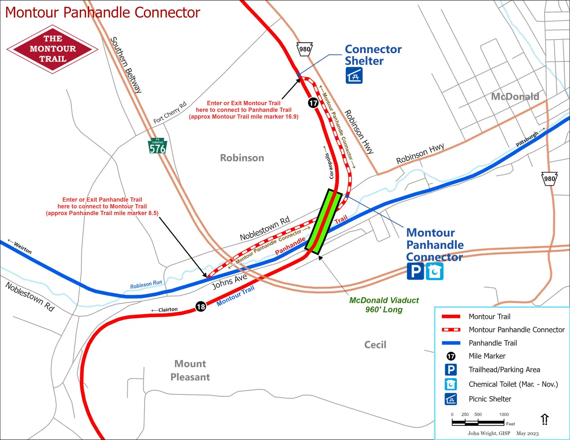
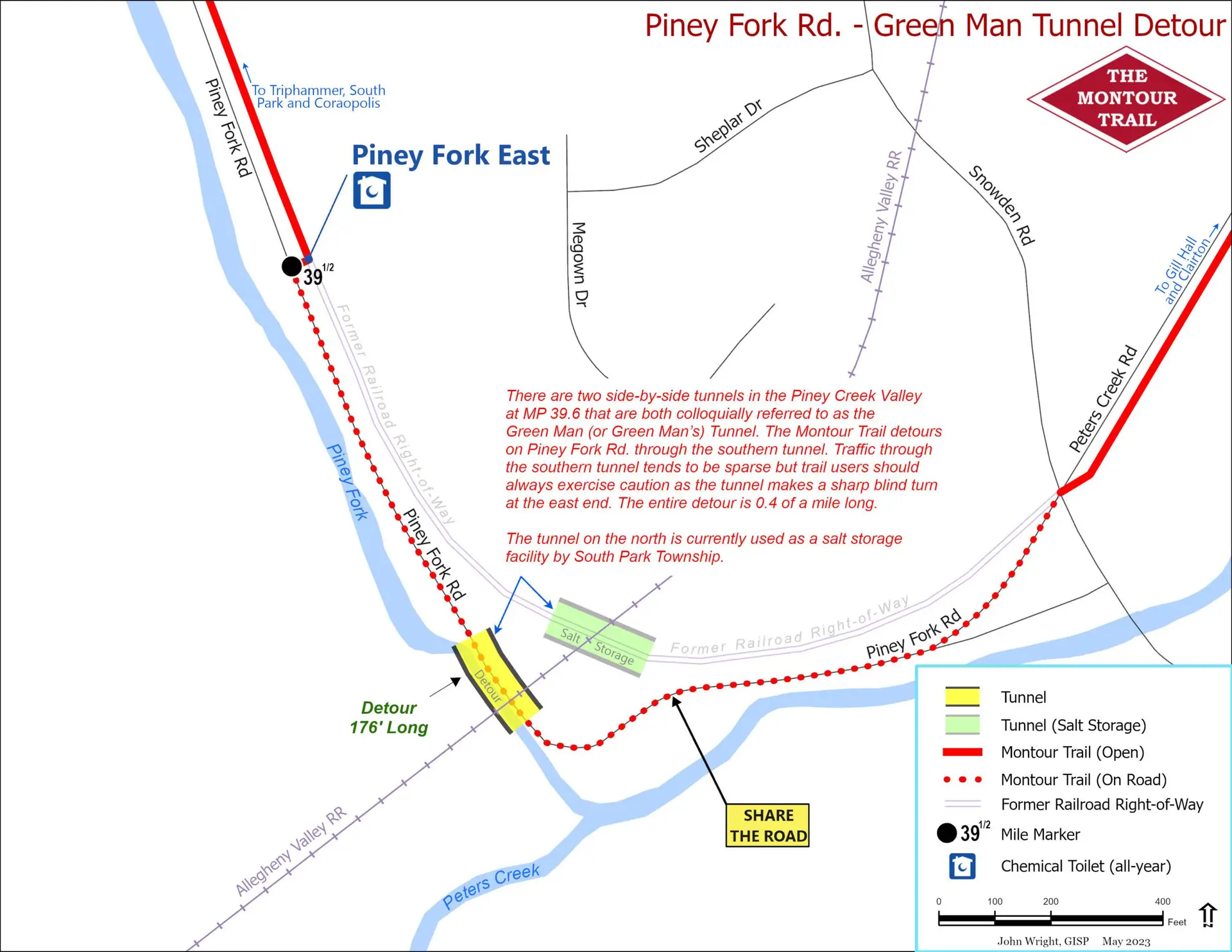
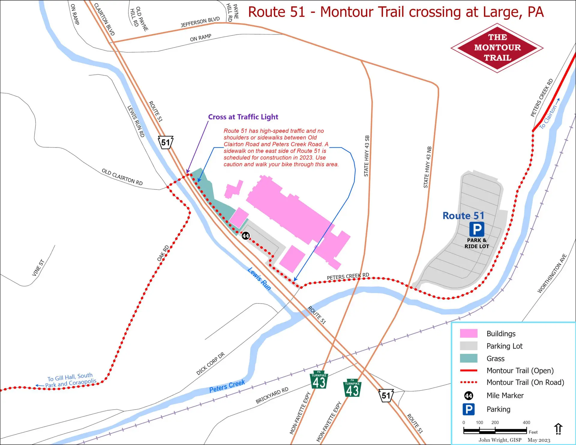
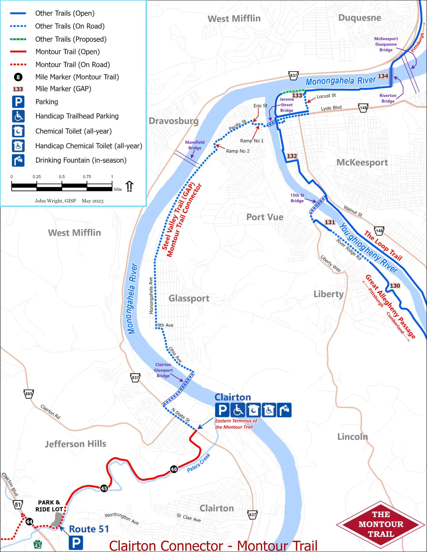
Interactive Map For interactive map anywhere. Click on the layer button at the top left to turn layers on and off.Click on the icons for more information about locations, such as campsites, trailheads and amenities. Mile markers are hidden by default. Static Map elevation map For an interactive elevation map click here. Follow the instructions on the splash screen to choose the area that you need an elevation profile for. distance guide Detours and connections These inset maps are useful for navigating specific sections of the Montour Trail.Airport Connector Montour/Panhandle Connector Piney Fork (tunnel detour) Route 51 Crossing Clairton Connector to GAP Please Donate