For an interactive elevation map click anywhere in this box. Follow the instructions on the splash screen to choose the area that you need an elevation profile for.
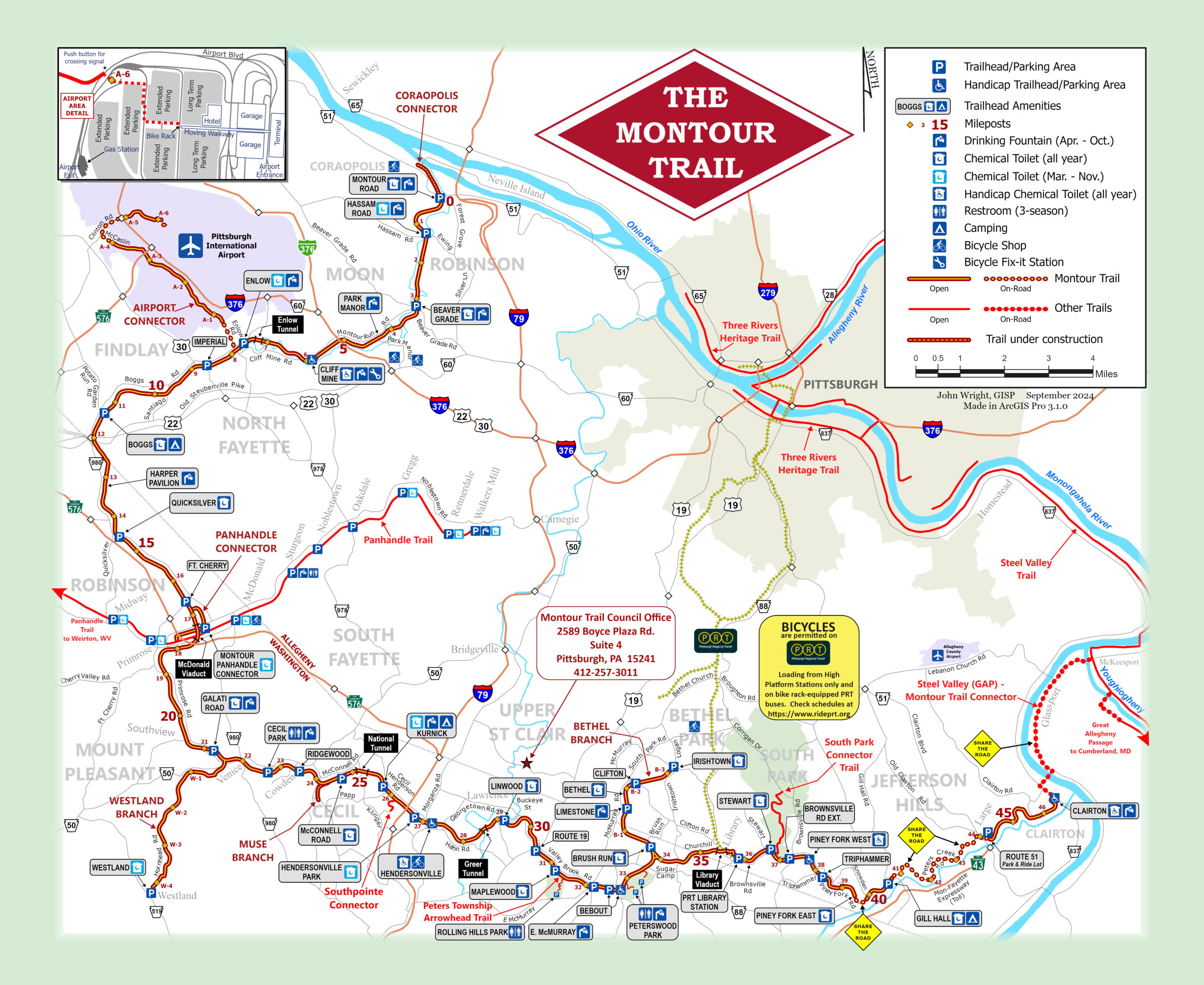
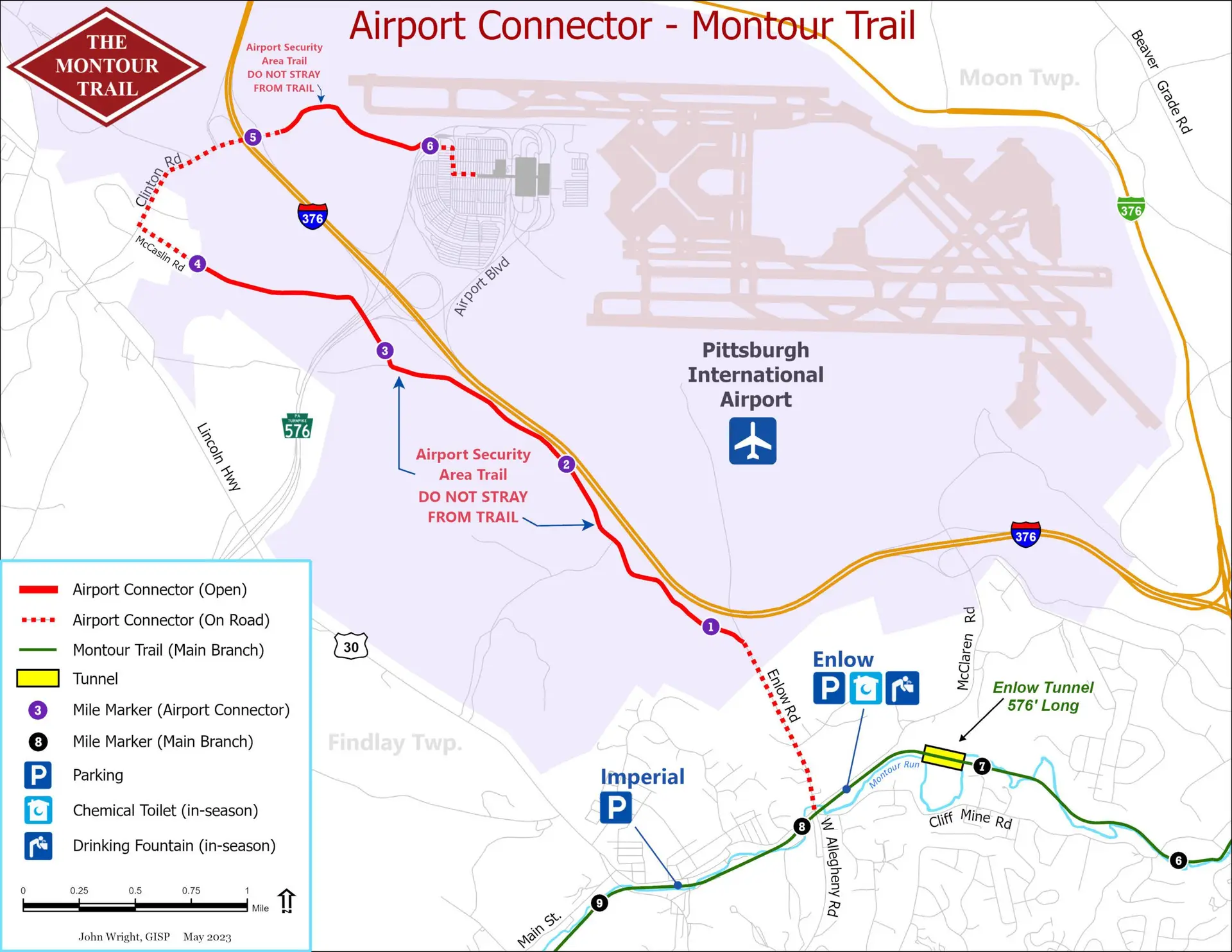
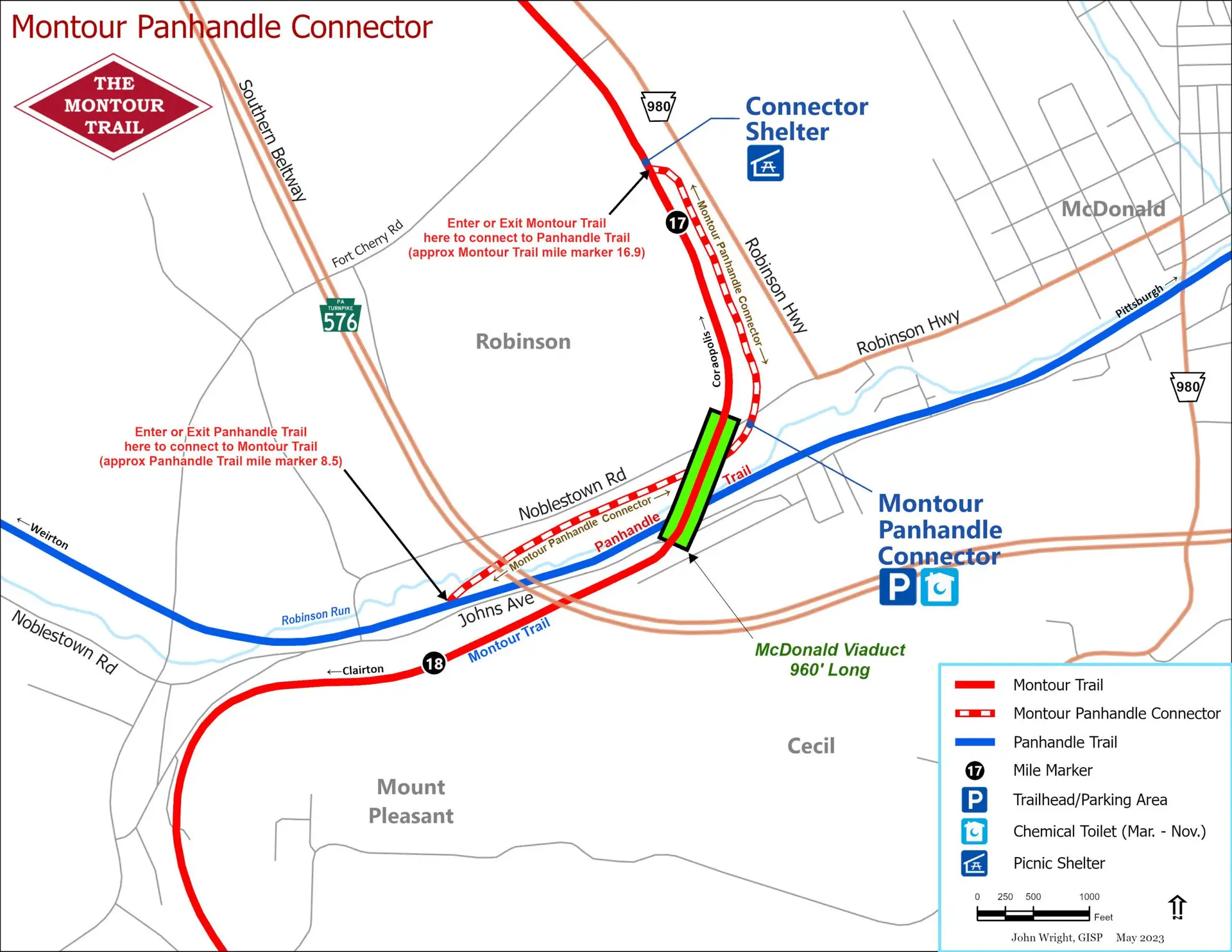
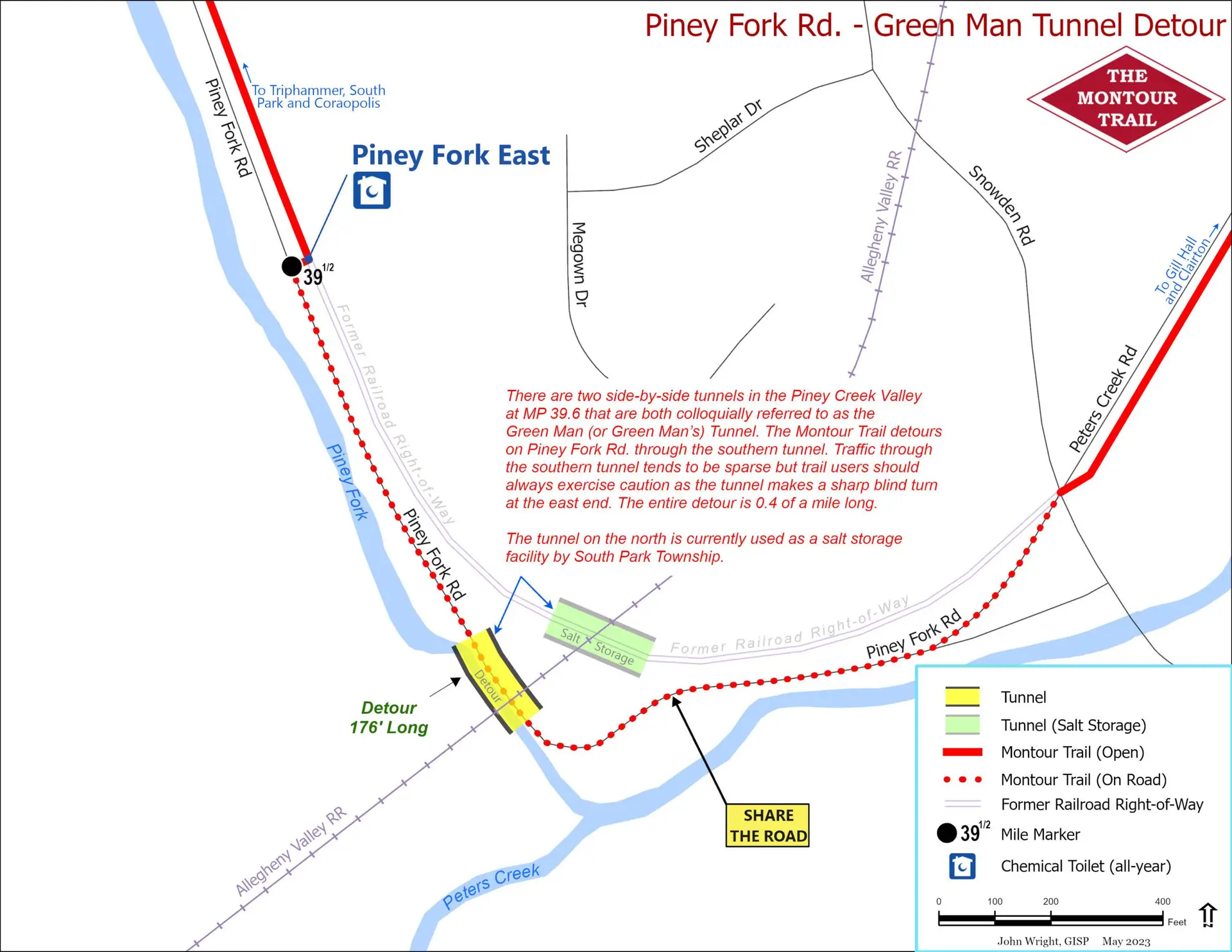
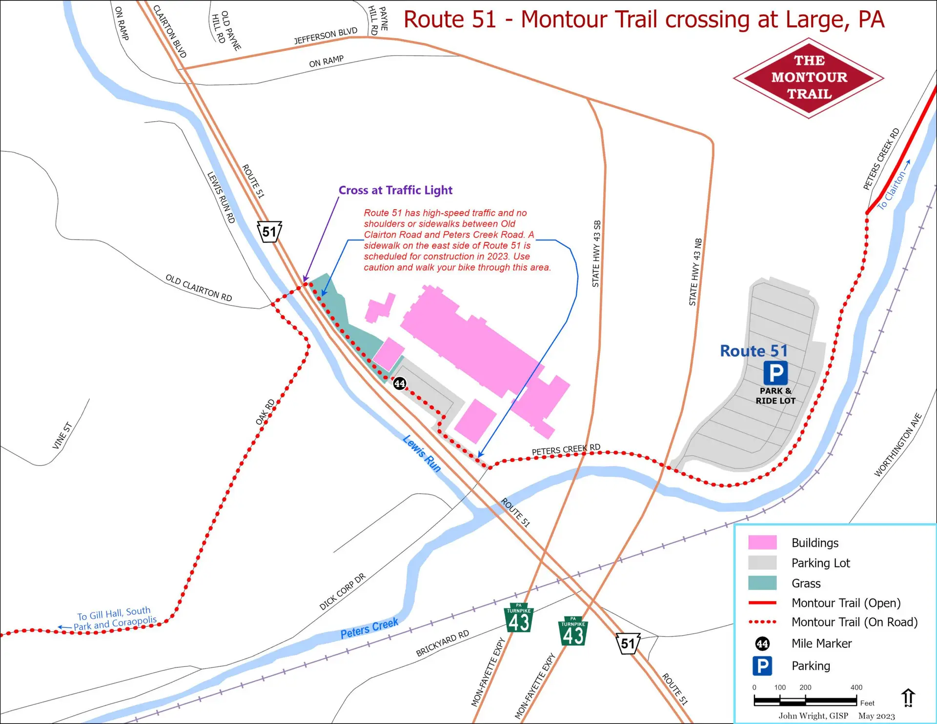
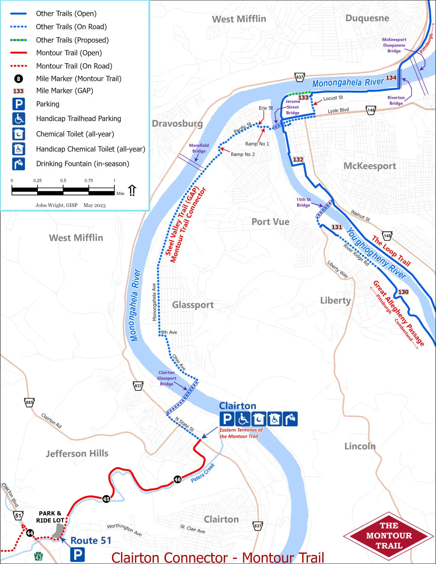
Detours and connections
These inset maps are useful for navigating specific sections of the Montour Trail. Click the appropriate link below.